Satle
Identify the city from satellite imagery.
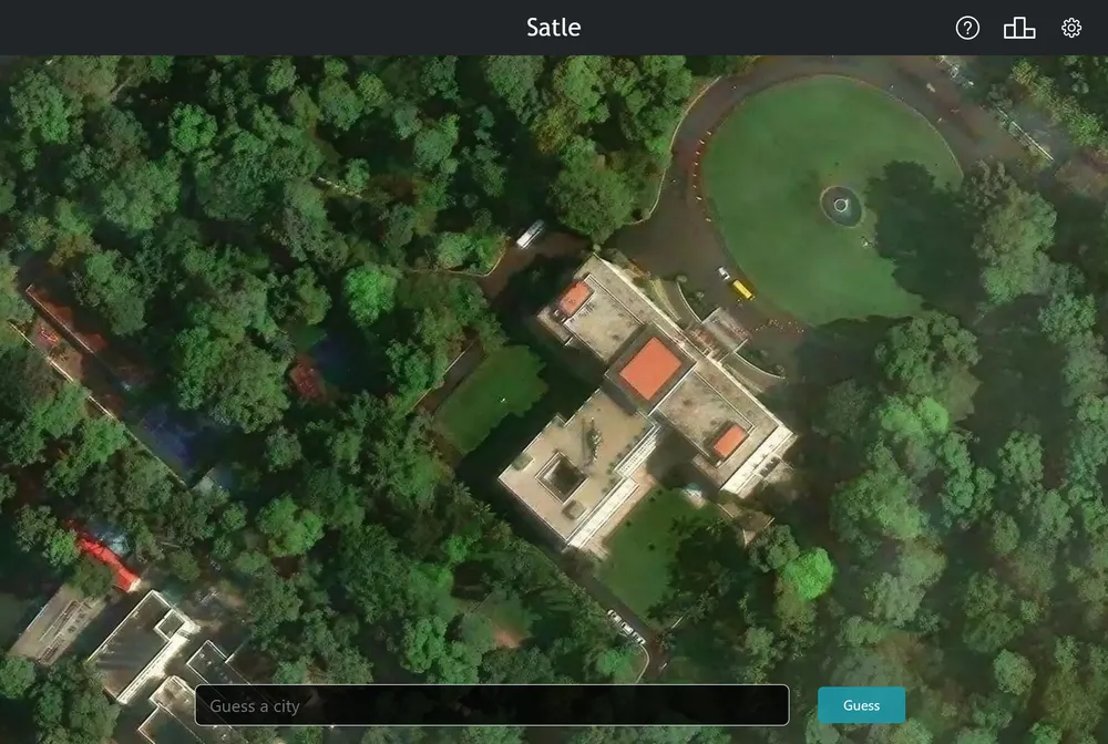
Satle is a daily geography game that shows you an overhead satellite image of a city somewhere in the world and asks you to name it. You get six tries, and each wrong guess zooms the image out to reveal more of the surrounding land. The game also tells you the direction and distance from your guess toward the correct city, and one new puzzle goes live each day for everyone.
What is Satle?
The core loop is short and visual. You start looking straight down at a tightly cropped satellite view, often just a stretch of streets, coastline, or a distinctive landmark, with almost no context around it. You pick a city and country from an autofill list and submit your guess. If you are wrong, two things happen: the image zooms out a step to show more of the region, and the game gives you a compass direction and a distance from your guess toward the real answer. The widening picture and the distance hint work together to steer you toward the target city over your six attempts.
Satle uses real satellite imagery rather than text, which is what separates it from word-based -dle games. Word games ask you to reason about letters, and Worldle asks you to identify a country from its silhouette. Satle instead tests whether you can recognize a specific city from above and then narrow it down using the direction and distance clues. You are reading actual overhead photography: the shape of a harbor, the grid of a street plan, the sprawl around a river. Because the view zooms out with each miss, a guess that felt impossible at the tightest crop can start to make sense once you can see the broader coastline or mountain range.
Satle was made by Brendan Innis, who has called it his first game. It runs at satle.ca, and the site notes that it moved to that address on February 24, 2023. There are companion apps for iOS and Android alongside the web version, and the apps are free to download. The settings are short and practical: you can switch the distance units between kilometers and miles and toggle whether the distance is shown, which helps players who are used to one system or the other.
There is one puzzle a day and no timer pressure, and the page shows a countdown to the next Satle. When you want to reach the maker, the site points you to email feedback rather than an in-game form. It is a small, focused daily puzzle rather than a game with many modes.
How to play Satle
- Open Satle at satle.ca, or install the iOS or Android app.
- Study the first satellite image, which is a tight overhead crop of a single world city.
- Type a city and choose from the autofill list, which pairs the city with its country, to lock in your guess.
- Read the direction and distance the game shows toward the correct city, and note how the image zooms out.
- Use the wider view and the distance hints to refine your next guess, continuing across up to six tries.
- Adjust the settings if you like, such as switching distance units between kilometers and miles.
Tips and strategy
- Read the street pattern and coastline shape in the first tight crop before you guess, since those often point to a region even when the city itself is unclear.
- Treat the direction and distance hint as a compass. Each miss narrows down which part of the world the answer sits in.
- Let the zoom work for you. A wrong guess that widens the view can reveal a river, mountain range, or coast that identifies the area.
- Check the units setting so you read the distance correctly, whether you think in kilometers or miles.
- Scroll back through your earlier guesses and their images to compare context you may have missed the first time.
- Learn how distinctive geography looks from above, such as island clusters, ring roads, or river deltas, so recurring city types get easier to spot.
Good to know
- Category
- Geography
- Guesses
- 6 tries
- Resets
- Daily, one new puzzle each day
- Cost
- Free to play on the web
- Modes
- Single daily puzzle
- Creator
- Brendan Innis
- Platform
- Web, iOS, Android
- Feedback
- Via email
Satle FAQ
Is Satle free?
Yes. The web version at satle.ca is free to play, and there are also free companion apps for iOS and Android.
How do you play Satle?
You are shown a satellite image of a world city and pick a city and country from an autofill list. Each wrong guess zooms the image out and shows the direction and distance toward the correct city, and you have six tries.
When does Satle reset?
A new Satle is available each day, so there is one shared city to solve daily. The site shows a countdown to the next puzzle.
Is Satle like Wordle?
It shares the daily, guess-in-six format, but instead of letters it uses real satellite imagery of a city. Unlike Worldle, which shows a country silhouette, Satle zooms out an overhead photo and gives direction and distance hints toward a specific city.
Who made Satle?
Satle was created by Brendan Innis, who has called it his first game. It is hosted at satle.ca.