Locatle
Guess the country using distance and direction clues.
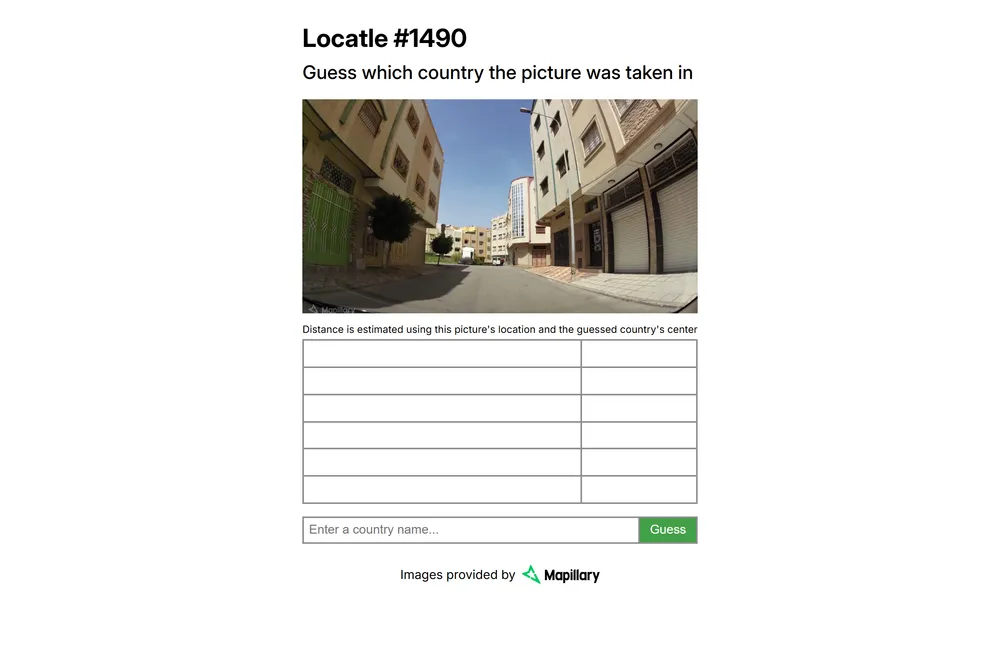
Locatle shows you a single street-level photograph, sourced from Mapillary, and asks one question: which country was this taken in? The game scores your guess by the distance between the photo's real location and the center of the country you picked. Its own GitHub repository describes it as a Wordle inspired game, and it comes with Wordle's signature Share button for posting your result.
What is Locatle?
Locatle strips geography guessing down to one photo and one question. The page's only instruction reads "Guess which country the picture was taken in." You can zoom in on the photo with plus and minus controls to study the terrain, vegetation, road markings, or architecture, then submit your answer through the Guess button. You are picking a country, not an exact coordinate, which makes the game more approachable than pixel-perfect location guessers while still rewarding real geographic knowledge about climate, road signage styles, vegetation, and building materials around the world. What sets Locatle apart from other geography -dles is its scoring method. Instead of measuring the distance between your guess and the photo's exact spot, Locatle measures the distance from the photo's true location to the center point of whichever country you guessed. The site states this directly: distance is estimated using the picture's location and the guessed country's center. That means naming the correct country is what matters most, and guessing a neighboring country still earns you a reasonably close score. It is a coarser, friendlier version of the exact-pin distance scoring used by games like GeoGuessr, built around country-level thinking rather than pinpoint accuracy. The game is an open-source project hosted under the strct-net account on GitHub, released under an MIT license with a 2022 copyright to PaddiM8 and written mostly in JavaScript and Python. It runs entirely in the browser with no login or payment. The street-level photos come from Mapillary, a crowdsourced street imagery platform, which the game credits directly on the page. After you guess, Locatle reports the distance between the photo's real location and your guessed country's center, and gives you a Share button so you can post your result the way Wordle players share their grids. The overall feel is quiet and minimal: one photo, one guess, one distance score, nothing else competing for your attention on the page.
How to play Locatle
- Open Locatle at locatle.strct.net
- Study the street-level photo shown on the page, using the plus and minus zoom controls to look closer at details like terrain, plants, roads, and buildings
- Think about which country the scene most likely belongs to based on those visual clues
- Submit your answer with the Guess button
- Read your result, which is based on the distance between the photo's real location and the center of the country you guessed
- Use the Share button to post your result if you want to compare with others
Tips and strategy
- Zoom in before you guess. The plus and minus controls exist because small details like license plates, road paint, or building materials often carry the strongest clues
- Look at vegetation and terrain first. Climate zone narrows your options faster than almost anything else in the photo
- Check the road itself. Lane markings, curb style, and pavement color vary a lot by region and can point you toward a continent quickly
- Remember that scoring uses the guessed country's center, not the exact spot. Getting the right country matters more than working out the precise town or region within it
- When you are unsure, guess the country whose overall geography, not just one feature, best matches everything you see in the photo
- The photos come from Mapillary's crowdsourced street imagery, so expect ordinary roadside scenes rather than tourist landmarks. Training your eye on architecture, utility poles, and road infrastructure across regions pays off over time
Good to know
- Category
- Geography guessing game
- Cost
- Free to play, no login required
- Modes
- One mode: guess the country from a street-level photo
- Feedback
- Distance from the photo's true location to your guessed country's center
- Photo source
- Street-level images provided by Mapillary
- Creator
- Open source under the strct-net GitHub account, MIT license, copyright 2022 PaddiM8
- Platform
- Web browser
- Sharing
- Share button for posting results, in the Wordle tradition
Locatle FAQ
Is Locatle free to play?
Yes. Locatle runs in the browser with no login, account, or payment required.
How do you play Locatle?
You are shown a single street-level photo. Zoom in to study it, then guess which country the photo was taken in. Your score is based on the distance from the photo's real location to the center of the country you guessed.
Does Locatle reset with a new puzzle each day?
The project describes itself as Wordle inspired, but the live page does not show a countdown, streak tracker, or explicit daily label, so we cannot confirm a daily reset from the site itself.
Is Locatle like Wordle?
Its own GitHub description calls it a Wordle inspired game, and it has a Share button for posting your result. Instead of guessing a word, you guess a country from a photo, and instead of colored tiles, your feedback is a distance score.
Who made Locatle?
Locatle is an open-source project hosted under the strct-net account on GitHub, released under an MIT license with a 2022 copyright to PaddiM8.