Statele
Guess the U.S. state from its outline.
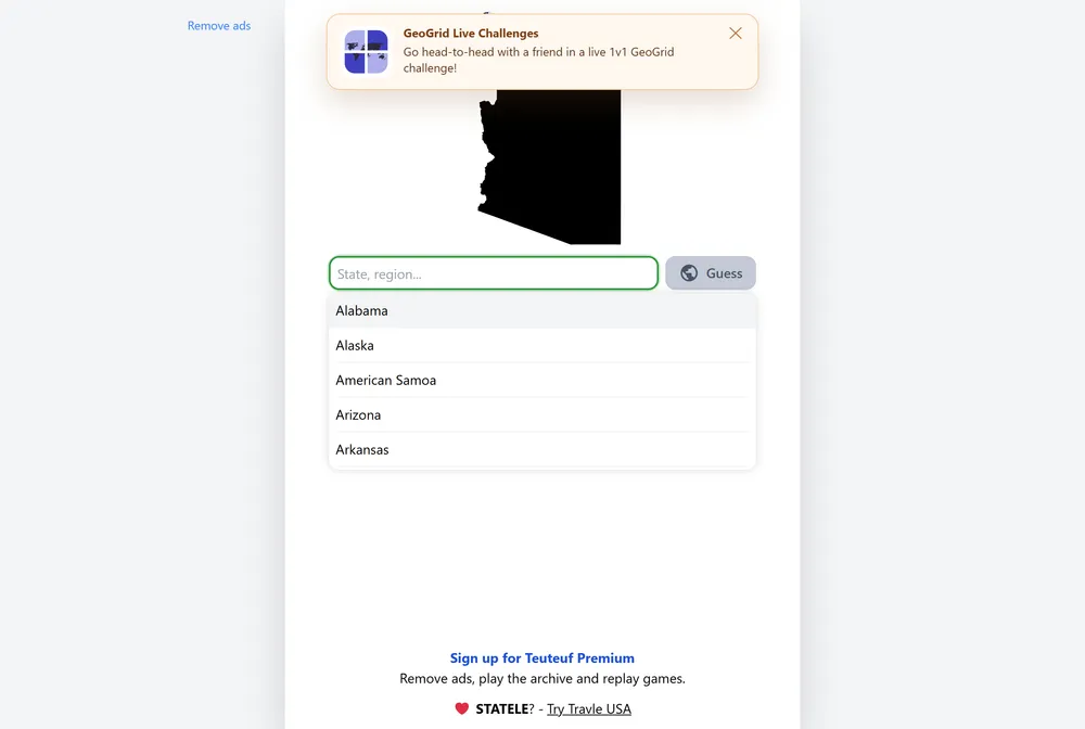
Statele hands you the blank outline of one US state each day and asks a deceptively simple question: which state is this? After every guess it tells you the distance to the target, the compass direction to travel, and a proximity percentage, so even a wrong answer pulls you closer. It is the state-level take on the silhouette-guessing format, one map a day shared by every player.
What is Statele?
Statele is a daily geography puzzle built around a single image: the bare outline of one US state, stripped of labels, rivers, and surrounding context. Your job is to name that state in six guesses or fewer. Each guess has to be a real US state, a US territory such as Puerto Rico, or Washington, D.C., which keeps the answer pool tight and rewards players who actually know the map rather than typing random words. Everyone in the world sees the same shape on the same day, so the morning's puzzle becomes a shared talking point the way the original word game's daily entry did.
What sets Statele apart from a typical Wordle clone is that it is spatial, not alphabetical. You are not narrowing down letters; you are narrowing down a location on a map. After you submit a guess, Statele reports three things at once: the straight-line distance from your guessed state to the hidden one, a directional indicator such as north-east or west pointing toward the answer, and a proximity percentage that climbs as you get warmer. That distance is measured capital to capital, between the capital city of the state you guessed and the capital of the target, so it reflects how far apart the two states sit rather than the gap between their nearest edges. A guess hundreds of kilometers away with an arrow pointing northwest is a clear instruction to jump across the country, while a small distance and a high percentage mean the answer is a neighbor or two away.
Distance shows in kilometers by default, matching the value used on the game's rules page, but Statele lets you flip the unit to miles if you prefer imperial measurements, so the same feedback reads naturally whichever system you think in. Statele comes from Teuteuf, the studio behind the country-guessing game Worldle, which was originally created by French developer Antoine Teuf before the wider Teuteuf catalog grew around it. Statele applies that same proven silhouette-and-distance idea to the fifty states plus territories and D.C., so fans of the country version get a more granular, US-focused challenge. The lineage shows in the polish: clean outlines, consistent feedback, and a format that needs no tutorial beyond a single read of the rules.
When you finish, Statele turns your performance into a spoiler-free grid of colored squares that you can copy and paste to friends or social media without revealing the day's state. The squares encode how close each guess landed rather than the answer itself, so sharing your score never ruins the puzzle for anyone who has not played yet. The difficulty swings with the day's draw: instantly recognizable shapes like Florida or California are gifts, while squarish interior states with few distinguishing edges can burn several guesses. A blocky state in the country's middle gives the eye almost nothing to latch onto, and that is exactly where the distance arrow and proximity percentage earn their keep, turning a guessing game into a step-by-step triangulation.
How to play Statele
- Open Statele and study the day's state outline, which appears with no name or labels.
- Type your first guess, which must be a US state, a US territory like Puerto Rico, or Washington, D.C.
- Read the feedback: the capital-to-capital distance, the direction arrow pointing toward the answer, and the proximity percentage.
- Use the arrow to decide which way to move and the distance to judge how far, then pick a state in that direction.
- Submit follow-up guesses, watching the proximity percentage rise as you close in.
- Name the correct state within your six guesses, then copy the colored-square grid to share your result.
Tips and strategy
- Spend your first guess on a state near the middle of the country, such as Kansas or Missouri, so the direction arrow can point you toward any corner of the map.
- Read the silhouette for tells before guessing: panhandles, peninsulas, and long straight borders often pin a shape to one region instantly.
- Treat the distance reading as a budget. A few hundred kilometers means hop one or two states over, not across the country.
- Follow the direction arrow precisely. If it points north-east and your distance is small, the answer is likely an immediate neighbor in that exact corner.
- Switch the distance unit to miles in the settings if imperial measurements are easier for you to gauge at a glance; the feedback works the same either way.
- Remember that territories and D.C. are valid answers, so do not rule them out when a shape looks unusually small or unfamiliar.
- Watch the proximity percentage between guesses; a jump from 60 to 90 percent confirms you moved the right way, while a drop tells you to reverse course.
Good to know
- Resets
- Daily, a new state every day
- Guesses
- 6 attempts
- Valid answers
- US states, US territories, and D.C.
- Cost
- Free to play
- Feedback
- Capital-to-capital distance, direction arrow, proximity percentage
- Distance unit
- Kilometers by default, switchable to miles
- Publisher
- Teuteuf (makers of Worldle)
Statele FAQ
Is Statele free?
Yes. Statele is free to play in your browser, with a new puzzle posted every day at no cost.
How many guesses do you get in Statele?
You get six guesses. Each one must be a valid US state, a US territory such as Puerto Rico, or Washington, D.C.
What feedback does Statele give after a guess?
After each guess it shows the distance to the target state, measured capital to capital, a direction arrow pointing toward it, and a proximity percentage that rises as you get closer.
Can I change the distance from kilometers to miles?
Yes. Statele shows distance in kilometers by default, but you can toggle the unit to miles in the settings if you prefer imperial measurements.
Is Statele related to Wordle?
It shares the daily, limited-guess, shareable-result format popularized by Wordle, but it is a geography game. Statele comes from Teuteuf, the studio behind the country game Worldle, and uses map distance and direction instead of letters.
Can I share my Statele result?
Yes. When you finish, Statele generates a spoiler-free grid of colored squares that you can copy and paste to friends or social media without giving away the day's state.